

NGA
- North America
- Central, South America
- Western Africa, Mediterranean, Black Sea
- Eastern Africa, Southern Asia
- Australia, New Zealand, Indonesia, Papua New Guinea
- South Pacific Islands
- Eastern Asia, South Eastern Russia, Philippines
- Other Regions
Canadian
Caribbean and Mediterranean
Norwegian
SHOM
SEMAR
U.S.
Search by chart title, key word or chart number:
Intracoastal Waterway Chartbooks
Enlarged Views When Space Is Limited
Specially designed for easy reference and plotting, these NOAA-approved chart segments are arranged consecutively in spiral-bound booklets. Each book includes enlarged and segmented coastal charts, spiral bound for easier reference and plotting. Because each book contains sequential blow-ups of one chart, mariners can more easily focus on a particular area and identify hazards and obstructions, as well as aids to navigation.
NOAA-approved and 100% up to date when you order! Browse our intracoastal chartbooks, below!
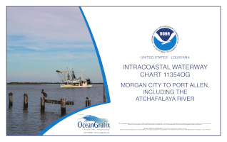
Intracoastal Waterway Morgan City to Port Allen, including the Atchafalaya River
System (book of 27 chart segments)
Chart#: 11354OG
Scales: 1:15000, 1:20000, 1:40000
$35.00
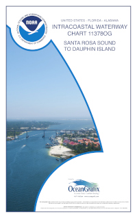
Intracoastal Waterway Santa Rosa Sound to Dauphin Island
System (book of 31 chart segments)
Chart#: 11378OG
Scales: 1:33000, 1:15000, 1:12000
$35.00


©2026 Nautical Charts Online, All Rights Reserved.