

NGA
- North America
- Central, South America
- Western Africa, Mediterranean, Black Sea
- Eastern Africa, Southern Asia
- Australia, New Zealand, Indonesia, Papua New Guinea
- South Pacific Islands
- Eastern Asia, South Eastern Russia, Philippines
- Other Regions
Canadian
Caribbean and Mediterranean
Norwegian
SHOM
SEMAR
U.S.
Search by chart title, key word or chart number:
Bahamas Explorer Chartbooks
Charts and Cruising Guides around the Bahamas
Authors Monty and Sara Lewis have cruised and charted the Bahamas for more than a decade in their trawler SARANADE. In doing so, they've created an Explorer Chartbook series meant to be helpful for mariners exploring the Bahamas. Waterproof versions are the most popular and durable, but all guidebooks are also available in standard paper format.
Each chartbook offers intuitively shaded, cruiser-friendly charts ranging from small-scale route planning to closeup harbour charts. WGS 84 map datum for GPS navigation is augmented with frequently updated soundings, bottom contours, routes and waypoints. "Need-to-Know" cruising guide sections provide all the essential instructional information for boaters, including facilities and services for each island community plus Tide Tables through 2025.
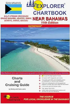
Near Bahamas Explorer Chartbook
11th Edition
The Near Bahamas Chartbook provides details for a tropical cruising paradise just a short distance from the U.S. mainland. This guide includes detailed Gulf Stream Crossing routes plus small- and large-scale charts of the Abacos, the Biminis, the Berrys, Grand Bahama, New Providence and Andros. It contains 77 large- and small-scale, full-color charts and closeups along with Tide Tables through 2025. Special articles include Customs and Immigration, Bahamas weather, anchoring, reading the water, fishing regulations, flight services and an extensive help menu.
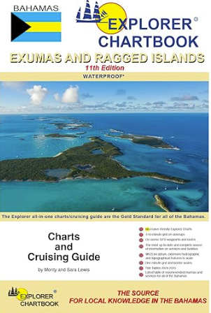
Exumas & Ragged Islands Explorer Chartbook
11th Edition
This edition gives mariners access to chart coverage of the central cruising ground of the Bahamas. Charts are digitally redrawn to pinpoint accuracy using aerial photographs. This chartbook includes 66 charts plus two new charts—crossing the Yellow Bank and Emerald Bay. You'll notice new and corrected data, depth contours, updated variations and chart page overlaps. The authors have conducted new surveys in many areas, most extensively in the Ragged Island chain.
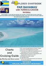
Far Bahamas with Turks and Caicos Explorer Chartbook
9th Edition
The Far Bahamas with Turks and Caicos guidebook brings you the most up-to-date charts and cruising guide information for the islands stretching from Eleuthera to Turks and Caicos. Every of the 91 charts and settlement’s Need-to-Know Info has been revised and updated so that you can confidently explore the outer reaches of the Bahamian/Turks and Caicos archipelago.


©2026 Nautical Charts Online, All Rights Reserved.