

NGA
- North America
- Central, South America
- Western Africa, Mediterranean, Black Sea
- Eastern Africa, Southern Asia
- Australia, New Zealand, Indonesia, Papua New Guinea
- South Pacific Islands
- Eastern Asia, South Eastern Russia, Philippines
- Other Regions
Canadian
Caribbean and Mediterranean
Norwegian
SHOM
SEMAR
U.S.
Search by chart title, key word or chart number:
Imray Charts for Caribbean and Mediterranean Waters
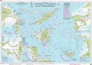 Navigate the Caribbean and Mediterranean!
Explore the Caribbean and Mediterranean‐two of the most popular destinations in the world‐safely with accurate paper charts from Imray, a long-respected chart provider known for its award-winning cartography and distinctive color schemes.
Imray charts are available here:
I need a chart for U.S. waters

©2026 Nautical Charts Online, All Rights Reserved.