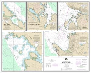
NOAA Nautical Chart 17423PM
Harbor Charts-Clarence Strait and Behm Canal Dewey Anchorage, Etolin Island;Ratz Harbor, Prince of Wales Island;Naha Bay, Revillagigedo Island;Tolstoi and Thorne Bays, Prince of Wales ls.;Union Bay, Cleveland Peninsula,
High-Quality Prints
Not For Navigational Use
Placemat Size: 15.0" x 12.0"
Enhance your dining table setting with Nautical Placemats. These durable placemats are the perfect way to breathe life into your next dinner party, special occasion, or family dinner by the water. Created using synthetic waterproof material; each placemat is water, tear, and stain resistant. Quick and easy to clean, these placemats are perfect for protecting tabletops against messes and spills. Choose your favorite charts to mix and match, which will create interesting dinner conversations.


